The full name of the reserve is the Kh. G. Shaposhnikov Caucasian State Natural Biosphere Reserve. This is the largest and oldest protected natural area in the North Caucasus.

The Caucasus Reserve has received international recognition as a standard of territory with a virgin natural environment that has preserved pristine landscapes with unique flora and fauna. On February 19, 1979, by decision of UNESCO, the reserve was given the status of a biosphere reserve. In 1999, the territory of the Caucasian State Natural Biosphere Reserve, together with the territory of the Krasnodar Territory and the Republic of Adygea, was included in the World Heritage List under the name Western Caucasus.
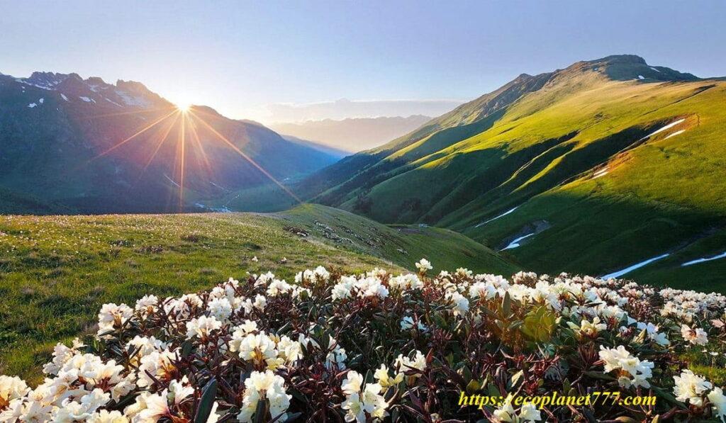
The reserve is an open-air natural laboratory where large-scale scientific research and environmental monitoring are carried out. Mountain and high-mountain ecosystems with absolute heights from 640 m to 3346 m are represented on the territory of the biosphere reserve. There are more than 124 named mountains, the highest is Tsakhvoa (3345 m).
Where is the Caucasian Reserve located?
It is located within three regions of the Russian Federation – the Krasnodar Territory, the Republic of Adygea and the Karachay-Cherkess Republic. This is the second largest mountain and forest reserve in Europe with a total area of 280 thousand hectares.
The Caucasian Biosphere Reserve was created on the territory of the hunting grounds that belonged to the former grand-ducal family, that is, the Russian tsars. The goal was to save the declining population of the Caucasian bison, since then the bison have become a symbol of the reserve and, fortunately, their numbers have increased.
The biosphere reserve has a special subtropical part located in the Khostinsky district of Sochi. This is a world-famous yew-boxwood grove with an area of 302 hectares. The grove is surrounded by a protected area, numerous reserves and natural monuments, and the Sochi National Park adjoins its southern border.
Animals of the Caucasian Biosphere Reserve

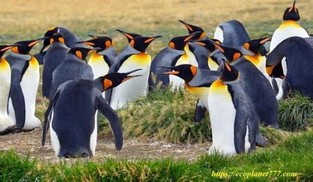
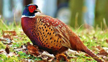
With the ban on active human activity, the biosphere reserve is a refuge for a huge number of animals. They roam freely on the slopes of large mountains, subalpine meadows and green valleys. The number of species living in the reserve exceeds 15,000. As of 2017, 1,700 Caucasian red deer (aka the royal deer), 1,300 chamois, 3,200 aurochs and 600 bears live in the reserve. There are 248 bird species and 89 mammal species. Other classes are also represented – numerous reptiles, amphibians, insects, mollusks, as well as 33 species of fish.
Bison, of course, are a special pride of the biosphere reserve. This is the heaviest and largest mammal on the European continent and the last representative of wild bulls. The mountain bison is a genetic lineage of the bison, restored in the Northwestern Caucasus in the second half of the 20th century.Scientists had to cross the remnants of the once mighty bison population with bison hybrids. In truth, at the time the project began, there was only one wild bison left on the planet, and only this bison produced so many offspring that now 1000 bison live on the mountain slopes. This is a success story recently repeated by the giant Galapagos tortoise that helped save its species.
Employees of the Caucasian Reserve are also involved in the restoration of the Persian leopard in the Caucasus. This program was developed by the Russian Academy of Sciences in cooperation with WWF Russia. Currently, five leopard reproduction centers are being built in the Caucasus of Russia in Krasnodar, Adygea, Ossetia and Dagestan. They will be connected into a single eco-corridor so that the population of these predators can successfully reproduce themselves over time.
Plants of the Western Caucasus Reserve

The flora of the Western Caucasus is rich in more than 2200 plant species. More than 900 species grow in the forests, 165 of which are trees and shrubs. There are 195 species of relict plants. In some areas, there are truly unique plants – thousand-year-old yews, alpine flowers, huge ferns. More than 30 species of orchids, 40 species of ferns grow here, there are pear-shaped, evergreen and many ornamental plants.
One of the most visited places in the Caucasian Biosphere Reserve is the Yew-Boxwood Grove, which is located separately in the city of Sochi. This relic forest covers an area of 300 hectares and has more than 400 species of unique plants, including the remains of pre-glacial forests, miraculously preserved in the only place on Earth. Throughout the territory of the natural biosphere reserve, you can find common yew – an evergreen coniferous plant that can live 2000 and even 2500 years. Here, on the Khostinsky site of the reserve, Colchis holly and Carian figs, Colchis boxwood and Colchis leptopus grow, as well as many other ancient representatives of the flora. Most of them are Red Book plants.
Caucasus Reserve Geology
The territory of the biosphere reserve has a complex geological structure. The oldest crystalline rocks, bordering on later limestones, sandstones and shale. Some areas (the Lagonaki Highlands, the Fisht, Oshten, Pshekho-Su, Acheshbok, Tru, Akhun, etc.) are karst landscapes with an amazing number of caves.Imagine, there are 130 caves in the Lagonaki Highlands alone. Glaciers in the reserve are not uncommon. There are about 60 of them, and the total area is 18.2 square kilometers. The largest glacier covers Mount Pseashkho and is 1.5 sq. km.
Rivers and lakes

Fast rivers and azure-blue lakes occupy about 2% of the territory of the Caucasian Biosphere Reserve.
On the southern slope of the Main Caucasian Range flow the rivers Mzymta with tributaries Chvizhepse, Laura, Achipse, Pslukh, Quiet, etc. Khosta, Sochi, Shakhe with tributaries Bzych, Azhu, Bushy, and others.
On the northern slope is the Belaya River with tributaries of the Chessu, Kish, Pshekha, etc., the Malaya Laba with tributaries of the Tsakhvoa and Urushten, the Zakan and Damkhurts rivers, belonging to the Bolshaya Laba basin.
The rivers flowing down the northern slope are tributaries of the Kuban River. They are typical mountain streams with a large number of rapids and waterfalls, narrow rocky gorges, ravines and canyons.
The lakes are numerous and offer wonderful opportunities for outdoor recreation and photography. Currently, only about 240 lakes have been identified on the territory of the reserve. Their diversity is amazing: there are both huge reservoirs, the banks of which stretch for many kilometers, and a scattering of tiny blue pools, too small to have their own names. The colors of the water are stunning and will please even the most fastidious tourist. Therefore, do not miss the opportunity to take your best shots of turquoise, green, azure, cobalt, ultramarine and steel gray lakes that will delight you in any weather.However, for most of the year, the lakes are practically inaccessible not only because of adverse weather conditions, but also because of thickets and rough rocks blocking the paths, so only large bison and chamois can observe the serenity of these natural reservoirs. The number of mountain lakes, their shape and size are not constant. As glaciers melt, new lakes form, rivers and avalanches change the shape of their shores, old lakes come to the end of their life cycle, turning into swamps.
The lakes of the Caucasus Reserve are relatively small in size and are often completely free of ice only by the middle of summer. The largest lake of the biosphere reserve is Lake of Silence (Silence) with an area of 200,000 sq.m. It is located at an altitude of 2530 meters above sea level. This name did not appear by chance. Surprising silence reigns around, not disturbed by the seething noise of swift rivers. The largest dammed lake is Kardyvach (1850 m), from which the river originates. Mzymta. Of particular beauty and popularity are Lake Khuko (1843 m) on the Main Caucasian Range, Inpsi in the upper reaches of the Tsakhvoa River, Lake Goluboe and Atsetuk.
Mountain ranges in the Caucasian Reserve

The main ridge (Great Caucasian ridge) is quite clearly traced from the city of Fisht (2867 m) in the west to the city of Adjara (2935 m) in the east. It is divided into northern, wider and southern. The Fisht-Oshten massif, Fisht Mountains (2867 m), Oshten Mountains (2804 m) and Pshekho-Su (2743 m) are the outpost of high-mountain relief and modern glaciation in the western part of the Main Caucasian Range.
The main peaks of the Main Caucasian Range: Chugush (3238 m), Urushten (3020 m), Northern Pseashkho (3257 m), Tsakhvoa (3345 m). To the north of the Big Ridge, at a distance of 2-25 km, there are peaks – Tybga (3065 m), Chelipsi (3097 m), Damkhurts (3193 m).
The reserve also partially covers the Southern Front Range, located south of the Greater Caucasus Range and stretching parallel to it from the northwest to the southeast. The ridge includes the highest point – Mount Agepsta (3256 m). There are also peaks in the vicinity: Psegef (1243 m), Psekhetuk (1283 m), Stagoki (1338 m), Autl (1855 m), Bolshaya Chura (2250 m), Achishkho (2390 m), Aibga (2462 m). ), Stone Pillar (2509 m), Efremov Peak (3114 m).
Biosphere Reserve. Main peaks
Mount Tsakhvoa

Tsakhvoa (3346 m) is the highest point of the Krasnodar Territory. On the northern slopes of the mountain is the largest glacier in the region. Its total area is about 2500 square meters, it descends along the steep rocky slopes in three narrow ridges. Mount Tsakhvoa is one of the most beautiful peaks of the Caucasus. It is popular with hikers and climbers.Climbing Tsakhvoa belongs to the category of difficulty 1B-2A according to climbing standards. Often groups preparing to climb Elbrus use Tsakhvoa as a base camp for acclimatization and getting in shape.
Mount Fisht

Fisht, aka White Head (2867 m) is a mountain peak in the western part of the Greater Caucasus Range. Fisht, together with the Oshten and Pshekho-Su peaks, forms the so-called Fisht-Oshten massif. The peaks of the massif rise significantly above the upper border of the forest with a wide belt of subalpine and alpine mountain meadows. In addition, Fisht is the westernmost peak of the Caucasus with glaciers on its slopes (Big and Small Fisht) and significant rock outcrops. Oshten, Pshekho-Su and Fisht form one mountain range with three well-defined peaks, separated from each other by a saddle lying in a southeasterly direction. Oshten, together with Fisht, are also the first peaks from the western tip of the Caucasus Range, rising to the height of the snow line and covered not only with snow, but also with small glaciers.
Mount Oshten

Unlike its older brother, Mount Fisht, which became widely known thanks to the Fisht Olympic Stadium built for the 2014 Olympics in Sochi, Oshten, aka Eternal Snow (2804 m), is less famous, but no less spectacular. This place is considered one of the most beautiful in Adygea. Caucasian chamois, or, as they are often called, black goats, live on the slopes of the mountain. From above, a beautiful view of its neighbors – Pshekho-Su and Fisht opens. In the south and west there are green mountain forests, low and narrow mountain ranges. In the north, from the top of all these three peaks, you can see the vast alpine meadows of the Lagonak plateau, the canyons of the Tsitse and Kurdzhips rivers, the Stone Sea and the Nagoi-Chuk ridges. Climbing Oshten is very popular, to get here, you need to buy a ticket at the border of the reserve.
Mount Pshekho-Su or Princess Water

Mount Pshekho-Su, also known as the Water Mountain of the Princess (2743 m) is the lowest in the Fishten-Oshten region, but no less beautiful than its larger counterparts. On the northeastern slope of the mountain there is a small glacier with an area of 0.1 sq. km. This is one of the three age-old glaciers of the Caucasus with deep low-lying faults. On the western side of the massif, at the junction of Mount Fisht and Pshekho-Su, there is one of the highest waterfalls in Europe. It is also known simply as the Waterfall (or Pshekho waterfall). This is a symbolic border of two mountain peaks: Fisht and Pshekho-Su.
It is hardly possible to call Mount Pshekho-Su especially famous for trekking, it is overshadowed by its neighboring Fisht and Oshten. However, Pshekho-Su also has its fans. After all, you can conquer this mountain if you are not an avid climber.It is enough to have an average level of sports training and some experience in climbing of moderate severity.
Mount Chugush

Chugush (3238 m) lies on the border of the Krasnodar Territory and the Republic of Adygea. The name can be translated from Adyghe as “top of the earth”. On the northern slopes of the mountain there are two glaciers with an area of 0.5 and 1.2 square meters. km, and on the eastern slope there is another glacier with an area of 0.5 sq. km. In fact, there are more glaciers, they are much smaller and usually do not have their own names, but only numbers. What should be noted, despite their modest size, most of them are dangerous and have very complex and deep crevices.
Chugush is a beautiful rocky peak, well viewed from the peaks of Sochi, Akhun and Achishkho. It is usually closed to visitors, so if you are lucky enough to climb it, you will see hundreds of Caucasian turs (European buffaloes) roaming the Chugush, reserve staff often leaving special salt for them.
Achishkho Ridge

The Achishkho Ridge, or “horse mountains” in translation from the Abkhaz language, in another version “goat mountains”, is a mountain range in the Western Caucasus, located in the Krasnodar Territory of Russia. The main peaks of the range: Achishkho-Main (2390 m), 10 km north-west of Krasnaya Polyana; Achishkho I East (2321.4 m), Achishkho II East (2363.2 m), Achishkho West (2317.7 m) and Horse Head (2159.0 m). The ridge is composed of shales and volcanic rocks. The landscape of the ridge is characterized by ancient glacial relief and lakes, including karst lakes. There are stunning waterfalls on the slopes, including the cascading Achipsinsky waterfall in the upper reaches of the Achypsa River.The slopes of Achishkho are covered with broad-leaved forests, mostly beech.
The Achishkho Ridge is known for its unique microclimate. Previously, there was a permanent weather station Achishkho on the western shoulder of the ridge, but now it is used only occasionally. The area is located in a humid climate zone – the annual rainfall is 3200 mm. The thickness of the snow cap reaches 4.8 m. The number of sunny days does not exceed 60-70 days a year.
Trekking to the highest point of the mountain range – the main peak of Achishkho (2390 m) – is one of the most popular routes in Krasnaya Polyana.
Mount Urushten
In the Urushten Range, only six passes have been described and studied. All of them are difficult to pass. That’s why meetings with other mountain lovers will be quite rare, which is very popular with those who are sincerely interested in untouched wilderness. The Urushten Range can be attributed to one of the waterless mountain systems in the area. There are no lakes or rivers in its area. The highest peak is Urushten (3020 m). The height of the passes here is more than 2700 meters, and one of them – Urushten Severny (2930 m) – is one of the highest passes in the Krasnodar Territory. But the most unusual and mysterious among them is the Crystal Pass.
Crystal mountain

Crystal Mountain, also known as Belorechenskaya (1976 m), lying between Mount Urushten and Aspidny Pass, fully justifies its name. In numerous caves and stone cavities, the so-called crystal cellars, travelers can find large outcrops of rock crystal. This colorless mineral, which is a variety of quartz, is a wonderfully transparent and sparkling crystal. In Soviet times, several hiking trails were laid across the mountain. Rock crystal was also used to build a horse road, along which the Circassians traveled to the Black Sea. This road was part of the ancient Silk caravan route to the sea, and then the military road. This is also the Caucasian “Trail of Tears”, along which slaves were transported in the old days and along which the Circassians also fled to Turkey.
Mount Pseashkho
 Pseashkho (3257 m) is located 20 km from the village of Krasnaya Polyana, in the upper reaches of the rivers Urushten, Malaya Laba, Pslukh. The name literally means “mountain with large water content”, apparently due to the fact that several rivers fed by glaciers flow on the slopes. Mount Pseashkho is the highest of the Pseashkho massif, which is a complex mountain junction with multidirectional ridges and peaks starting from 2500 m. The following peaks belong to the ridge: Northern Pseashkho (3256.9 m) – the main peak; Southern Pseashkho (3,251.2 m), Uzlovaya (3,004 m), Sugar Pseashkho, also known as Sugar Loaf (3,189 m), Western Pseashkho (2,899.8 m).
There are 11 glaciers in the Pseashkho massif.The largest of them, the Pseashkho glacier, is one of the largest glaciers in the Krasnodar Territory. The glacier has a length of 3 km and an area of 1.5 sq. km. To the north of the highest peak of the Northern Pseachkho is the Marble (Marble) glacier, which flows into the Marble River. Also on the northern slopes is the Kholodny glacier, from which the Kholodnaya River originates, which flows into the Urushten River after a few kilometers. Pseashkho is popular among tourists and climbers. Climbing routes of difficulty categories from 1B to 3B are laid on some peaks.
Attractions and routes
11 officially approved routes with a total length of about 450 km pass through the territory of the reserve. Among them is one of the most popular Soviet tourist routes – route No. 30 to the Fisht-Oshten massif. Permission is required to visit the reserve. All routes have marked trails and equipped parking lots. Routes can take from one day to a week, depending on the length and complexity. The most popular natural attractions are the Fisht, Oshten and Pshekho-Su lakes, the Huko and Kardyvach lakes, the Aishkha pass, the Pseashkho mountain range and the Achishkho ridge, the Engelman glades.
Bzerpi cornice
Climbing Bzerpi Peak (2483 m) and Mount Achishkho are two of the most popular one-day hikes suitable for hikers of all levels. They start from the Alpika-Service cable car station in Krasnaya Polyana. The 3S cable car allows you to climb to a height of 1660 meters, from where a leisurely ascent to the alpine meadows of Bzerpi takes only 2-2.5 hours.Bzerpi cornice (a kind of rock ledge, on one side of which the earth rises, and on the other it breaks off) is located at an altitude of about 2100 meters above sea level. The cornice offers a beautiful view of Krasnaya Polyana and the majestic mountains. Then you can climb the Bzerpi peak (2483 m). You can take a day trip or go hiking for two, three or even five days. The beauty of these trips is the opportunity to see the tour and chamois, and sometimes even the Caucasian bear. Subalpine herbs fill the air with the intoxicating aroma of herbs and flowers, and hardworking bees fly from flower to flower, collecting plenty of healing alpine honey.
The Bzerpi cornice ends with a steep cliff towards the Achipse River, hence its name. The path to the Bzerpi cornice lies through the Tabunny Ridge. You can go around or conquer it, see alpine glades, cliffs and rocks, as well as mountain rivers.
From the top of Mount Tabunnaya, you can enjoy a beautiful panorama of the Mzymta River Gorge, Krasnaya Polyana, Olympic venues, ski slopes, high peaks of the Greater Caucasus Range, and even, if you’re lucky with the weather, see the distant Black Sea.
Achipse waterfall

The route passes along the forest path to the high-mountain zone of the Achishkho massif, does not present technical difficulties and is accessible to almost everyone. Trekking through the picturesque alpine meadows to the Achipse waterfalls begins above the village of Krasnaya Polyana, Khmelevskoye and Zerkalnoe (Zerkalnoe) lakes, passing to the Achishkho ridge. Mirror Lake has viewing platforms with views of Aibga (2462 m), Chugush (3238 m) and Asara (2631 m). The trail runs along the eastern slope of Achishkho to the headwaters of the Achipse River, where the Achipse waterfalls are located.
These are the so-called azangwars, sometimes translated as “dwarf fence”, these are ancient stone structures, the origin of which is disputed, but it is assumed that they date back to 5000 BC. From the Achipse waterfall, the path goes up to the northern circus of Achishkho. The best time to visit the waterfalls is summer and the first half of autumn, when the alpine zone is completely covered with snow, and the waterfalls are full and appear before the traveler in all their glory.
Big Adzharia River – Engelman Glades

The route starts from the confluence of the Great Adzharia River into the Damkhurts River and passes 18 km above the Karapir border. It winds along the valleys of the Bolshaya Adzharia and Mzymta rivers through the Kvata pass and lakes Inpsi and Kardyvach in the forest and high mountain zones. On the way from Lake Kardyvach, you can admire Mount Turya (2716 m), and behind it opens the rocky Mount Agepsta (3256 m), crowned with eternal snows and glaciers. The Engelman glades (on average 1450 m above sea level) stretch in a narrow strip along the Mzymta River. These are luxurious meadows with abundant mineral springs.There are more than 120 mineral water springs on both banks of the river. Here, water rushes out of the ground in gurgling streams.
Lake Kardyvach
Lake Kardyvach (1838 m), formed as a result of the movement of the glacier about 3500 years ago. It has a glacial origin and an ellipsoidal shape. Due to the fact that the lake is hidden under ice for 7-8 months a year, even in summer the water does not warm up above +12°C. The lake covers an area of 133,000 square meters, has a length of 450-650 meters, a width of 230-450 meters and a depth of 23 meters. The size depends on the season and current precipitation. The longest river on the Black Sea coast of Russia Mzymta (89.6 km) originates in the southwestern part of the lake. Not far from the lake is the Emerald Falls.
Imereti waterfalls and Big Imeretinskoe lake

Lake Bolshoye Imeretinskoye (aka Lake of Silence) is the largest lake in the Caucasian Reserve. Its area is 198,000 sq.m. Despite its beauty and uniqueness, the lake has not been visited by people for a long time. It has one distinguishing feature: thirty meters from the eastern shore, a massive rocky island with steep steep banks rises above the transparent blue surface. The island is covered with grass, which makes its reflection in the serene waters of the lake even more spectacular.
The route to the border of Zakan and the Imereti lakes is famous for its beauty. This is one of the most popular officially permitted recreation routes in the reserve. To get to the lake, you need to overcome about 15 km and gain more than 1000 meters of height. Along the way, you will pass a variety of natural phenomena.Starting from a fabulous dense forest, you find yourself in thickets of subalpine tall grasses, which are so long that you can’t see a walking person in them. Then you will walk through the flowering alpine meadows, and if you want to rise above the Silence Lake, you will see gloomy stones and dazzling white snowfields. The great advantage of the route is that it is not difficult to navigate along it: it passes along the Imeretinka River. There are two very impressive waterfalls along the way. The lower one is a cascade 120 meters high, and the upper one is 60 meters high. In July, during the flood period, the Imereti waterfalls look very powerful.
Silence Lake

This lake appears quite unexpectedly when you enter the old, overgrown grass. The lake is extremely beautiful. It has the shape of a moon and is elongated in a north-south direction. In the southwestern part, it is connected by a shallow channel with an oval bay fed by snow plumes descending from the northern slopes of the giant circus. Such a shallow strait can be waded – in August, the depth barely reaches the waist of the average man. Caucasian tours live here. They are absolutely not afraid of people, sometimes they are fed by tourists. This route can continue to other lakes in the region: Riviera, Geographers, Bush and China. From Lake Celestial (Celestial) you should definitely climb the Celestial Pass, but only in good weather. From there you can see the lakes of the Humanoids and Oblivion.
Climate
The territory of the reserve is located on the border of the temperate and subtropical climatic zones and belongs to the humid western sub-region of the high-mountain climatic region of the Caucasus. The climate is quite mild, warm and humid. In the lowlands, the weather is usually characterized by positive average temperatures in January (+4.2) and high average temperatures in July and August (+20 or +21). Snow cover in the mountains lasts 5 months or more. The summer is moderately warm with the maximum amount of precipitation at the beginning of summer, the average July temperature ranges from 16° to 22°.
Winters are characterized by thaws caused by warm dry continental winds. At this time, the absolute maximum temperature in January can reach +15°C at altitudes of 1500-2000 m.
How to get there
The administration of the reserve is located in Sochi (Adler), and another representative office and scientific department are located in Maikop, the capital of the Republic of Adygea.
Since the territory of the reserve is huge, there are several branches, borders and checkpoints, the choice depends on which route you plan to visit:
The central estate of the Caucasian Reserve is located in Sochi, Adler district, Karl Marx street, 8
Big cities
Sochi
Sochi is the largest resort city in Russia, an important transport hub, as well as a major economic and cultural center of the Black Sea coast of Russia. It is also unofficially called the capital of summer, southern and resort life in Russia. In 2012, Forbes magazine recognized Sochi as the best city for doing business in the country.
In 2007, Sochi was chosen as the host of the 22nd Winter Olympic Games, which took place in 2014. On September 15, 2009, Sochi joined the World Union of Olympic Cities. In preparation for the Olympics, 500 billion rubles were spent on the development of the city and its infrastructure.
In 2018, the city hosted matches of the World Cup.
The most important factors that attract tourists to Sochi are the warm subtropical climate, rough sea, abundant mineral springs, proximity to the mountains, developed tourist and recreational infrastructure. The virgin Colchis forests of the Western Caucasus on the territory of the city (Caucasian State Biosphere Reserve) are included in the UNESCO World Heritage List.
From 3502 sq. km. of the total area of the resort city, 81% are specially protected territories and objects, incl.Caucasian State Biosphere Reserve, Sochi Republican State Natural Reserve and Sochi National Park. More than 80% of the city’s territory is covered with vegetation, represented by a wide range of species that can grow at different heights. You can see subtropical forests and glacial mountain vegetation in one day. Sochi is an all-season resort; 705 facilities are located on its territory, including 66 sanatoriums, 20 sanatoriums, 1 balneary and 618 hotels, including 42 new hotels. Resorts known in their own right: Matsesta, Khosta, Krasnaya Polyana, Dagomys, Adler. There are 183 beach areas, more than 100 tourist sites, about 70 tour operators.
Maykop
Founded in 1857, Maykop is currently the capital of the Republic of Adygea. The city grew out of a small fortress on the right bank of the Belaya River. Maykop is one of the most beautiful cities in the North Caucasus, the administrative and cultural center of Adygea. It has many amenities and can serve as an ideal base for hiking in the Caucasus Reserve. If you plan to visit the reserve from the Lagonaki checkpoint or the Eastern District Forestry, it is more convenient to stay in Maykop. The Adyghe scientific department of the reserve is also located here.
P.S.
If you liked and found this information useful, please share it on social media. networks with your friends and acquaintances. This is how you support our project “Ecology of Life” and make your contribution to the preservation of the environment!

- Magnetic storms: the sun is testing the planet🌪️ - 13.06.2024
- Why You Should Drink Chicory: Benefits and Harms 🌿 - 09.06.2024
- Innovative Choice: Sproud Milk – Your Ideal Plant-Based Drink 🌱 - 03.06.2024